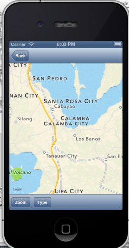
iPhone with MapKit and the MKMapView Class
Submitted by itachi_philip on Wednesday, February 27, 2013 - 13:46.
The MapKit Framework is based on the Apple Maps data and APIs and provides iPhone developers with a
simple mechanism for integrating detailed and interactive mapping capabilities into any application.
The core element of the MapKit framework from the point of view of the app developer is the MKMapView class. This class is a subclass of UIView and provides a canvas onto which map and satellite information may be presented to the user. Information may be presented in map, satellite or hybrid (whereby the map is superimposed onto the satellite image) form. The displayed geographical region may be changed manually by the user via a process of pinching stretching and panning gestures, or programmatically from within the application code via methods calls and property manipulation on the MkMapView instance. The current location of the device may also be displayed and tracked on the map view.
The MapKit framework also includes support for adding annotations to a map. This takes the form of a pin or custom image, title and subview that may be used to mark specific locations on a map.
Source: iPhone iOS6 Essentials PDF...
Note: Due to the size or complexity of this submission, the author has submitted it as a .zip file to shorten your download time. After downloading it, you will need a program like Winzip to decompress it.
Virus note: All files are scanned once-a-day by SourceCodester.com for viruses, but new viruses come out every day, so no prevention program can catch 100% of them.
FOR YOUR OWN SAFETY, PLEASE:
1. Re-scan downloaded files using your personal virus checker before using it.
2. NEVER, EVER run compiled files (.exe's, .ocx's, .dll's etc.)--only run source code.

